
Dearborn Heights ZIP Code Directory Coverage
Dearborn Heights is served principally by the 48125 and 48127 postal labels. Those are the two core labels for a local address search. The adjacent labels in the table are useful for checking a boundary, a historic address, or a postal-city mismatch, but they are not evidence that every address using the label lies within Dearborn Heights. USPS address lookup controls the exact ZIP and postal city returned for a particular delivery address.
| ZIP | Areas Covered | Post Office | Notes |
|---|---|---|---|
| 48125 | Core Dearborn Heights addresses, especially a southern and central city label | Dearborn Heights postal service or nearby stations; verify the exact address | Core city-serving ZIP; USPS controls the standardized result |
| 48127 | Core and northern Dearborn Heights addresses | Dearborn Heights Post Office, 26200 Ford Rd | Core city-serving ZIP; postal coverage is not a city-limit survey |
| 48124 | Adjacent Dearborn and Detroit-area postal label | Dearborn or nearby postal operation | Verify each address with a parcel and city record |
| 48126 | Adjacent Dearborn label | Dearborn postal operation | Postal-city label does not settle municipal location |
| 48141 | Adjacent Inkster label | Inkster postal operation | Historic geography makes an address-level check important |
| 48135 | Garden City label | Garden City postal operation | Surrounding-city ZIP, not blanket Dearborn Heights coverage |
| 48180 | Taylor label | Taylor postal operation | Surrounding-city ZIP |
| 48185 | Westland label | Westland postal operation | Surrounding-city ZIP |
| 48193 | USPS label grouping | No Dearborn Heights city post office located for this label | Do not treat it as city-limit coverage without address verification |
The source set did not identify a Dearborn Heights PO-box-only or unique institutional ZIP, a citywide ZIP boundary file, a ZIP realignment date, or ZIP-level population and registration counts. Those remain research gaps. A postal map can orient the search, but an exact result needs USPS and parcel verification.
Core Dearborn Heights Postal Labels
Use 48125 and 48127 as the initial postal labels for a Dearborn Heights address search. They are the labels the research identifies as serving the city. They do not create a shortcut around the address itself. A ZIP can cross municipal edges, and a municipal address can retain a postal label associated with a neighboring place. Record the full standardized address with its ZIP, then keep that postal result beside the municipal situs, or physical property location, from the city or county record.
This distinction helps when one record says Dearborn Heights and another uses Dearborn, Inkster, Garden City, Taylor, or Westland as its postal label. The difference may be ordinary postal routing rather than a contradiction. Compare the street address, parcel number, legal description, and municipality before combining records.
Dearborn Heights Post Office Details
The Dearborn Heights Post Office is listed by USPS at 26200 Ford Rd, Dearborn Heights, MI 48127-9998. Its published retail hours are Monday through Friday, 8:30 a.m. to 6 p.m., and Saturday, 9 a.m. to 6 p.m. The location is useful for postal-service questions and as a confirmation point for the 48127 label. It is not the custodian of municipal parcel records, deeds, or a ZIP-wide resident list.
A source image from the USPS Dearborn Heights Post Office listing shows the local postal-service result used for the office details.
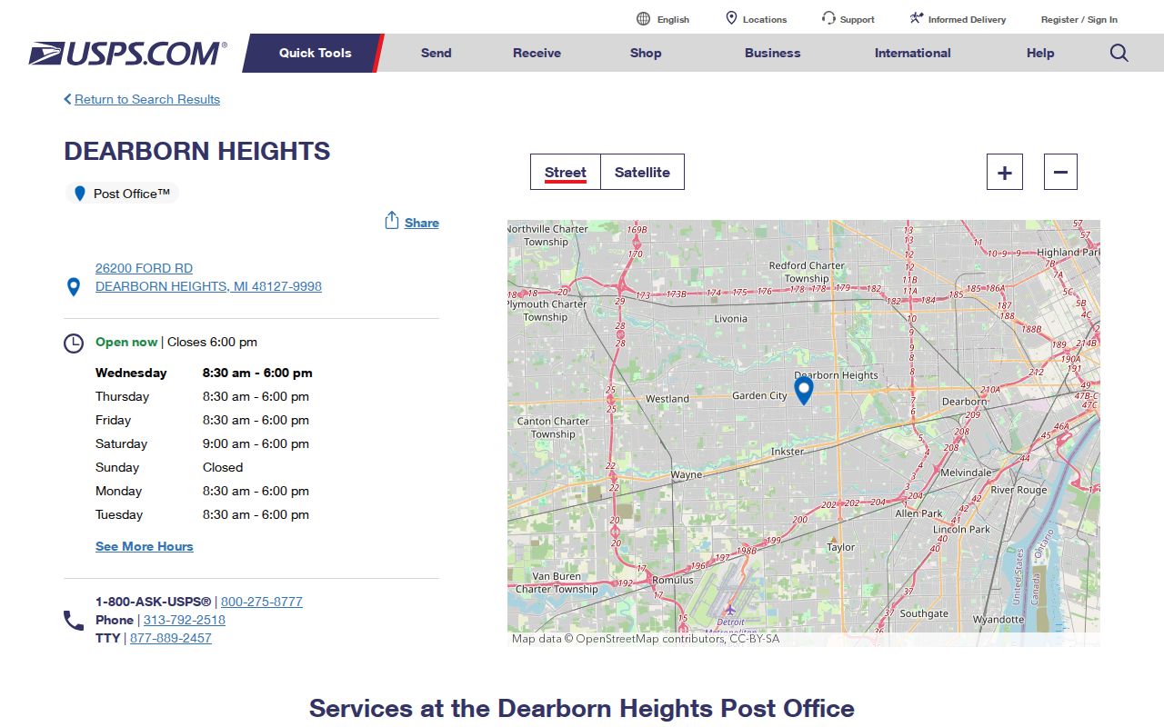
Use the live listing for service changes before making a trip, since location hours and offerings can change.
Verify a Dearborn Heights Postal Label
The USPS postal lookup offers three useful modes: by address, by city and state, and by ZIP. Address mode is the best choice when an exact street line is available. City-and-state mode can return a set of labels, so USPS directs people with multiple possible ZIPs back to address mode. Cities-by-ZIP returns postal city grouping, not proof of a municipal boundary.
| USPS field or mode | Use | Requirement and caution |
|---|---|---|
| By Address: Street Address | Checks a specific delivery line | Required in address mode; add a unit in the separate Apt/Suite field |
| By Address: City and State | Helps verify a proposed location | City and state fields are available; Michigan is the relevant state selection |
| By Address: ZIP | Tests a proposed postal code | Optional in address mode; USPS controls the returned standardized result |
| By City and State | Finds ZIP labels for a place | Both fields are required; use address mode if results leave more than one choice |
| Cities by ZIP | Shows postal city or label grouping | ZIP is required; it is not municipal proof |
A capture from the USPS lookup shows the official interface and its available search paths.
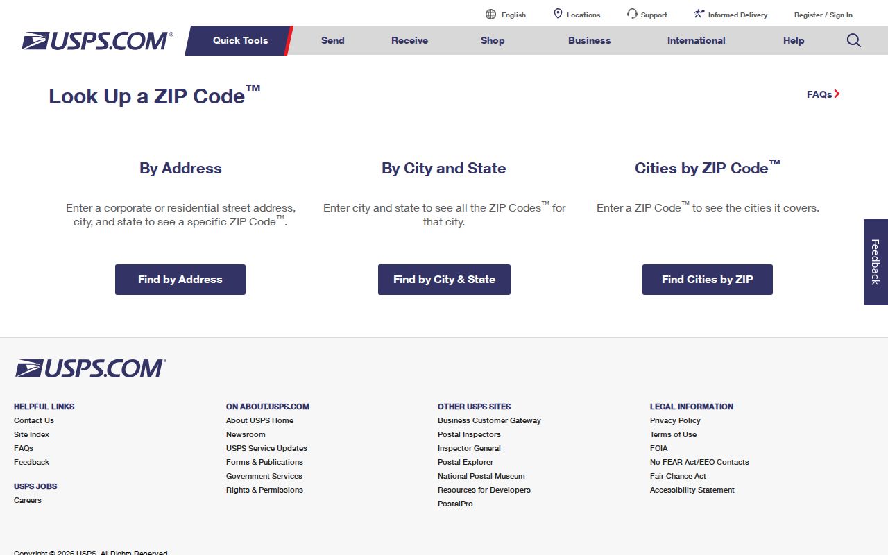
USPS explicitly warns that a result does not confirm that a person or company is located at an address. Treat the result as a postal input for the next record check.
ZIP Filters in Dearborn Heights Portals
Local systems do not provide one verified ZIP-wide search for everyone connected to a local address. The Dearborn Heights BS&A property hub identifies quick searches by address, owner name, and parcel number, not a verified ZIP filter. Wayne County's tax portal accepts municipality with street or parcel search, but it is not documented as a ZIP-wide tool and focuses on delinquent property-tax information. Wayne GIS and wcCompass are documented around an address and city selector, not a ZIP filter.
The Michigan Voter Information Center accepts a ZIP as part of an individual lookup alongside name and birth-month or birth-year information. It returns a matching voter and election-location information where available. It does not return all registrations in a ZIP. A statewide Qualified Voter File request is a separate written process with protected fields under Michigan law, not a casual ZIP roster.
When an address has been standardized, use the Dearborn Heights BS&A property search or the Wayne County interactive maps to confirm the parcel and municipality. The lack of a confirmed ZIP-wide filter is a reason to work address by address, not to infer a list from a postal label.
Find Records by Dearborn Heights Postal Label
A ZIP can organize the first step of a Dearborn Heights lookup, but the practical workflow ends with the individual address and its official record. Use this sequence when a letter, family note, or public document gives only a postal label and a partial address. It keeps postal data, parcel data, and person-level voter lookup results in their proper roles.
- Run the known street address through USPS in address mode. Save the returned postal city and ZIP exactly as shown.
- Use the standardized street line in the Wayne County map or Dearborn Heights BS&A property search to confirm the parcel and municipal situs.
- If the source carries only a person name, use MVIC as an individual name-and-ZIP lookup rather than expecting a ZIP-wide result.
- For tax information, search the Wayne portal by municipality and street or parcel. Do not describe its results as a resident directory.
- After a ZIP narrows the area, use the Dearborn Heights street directory for the full street-and-parcel workflow.
The sequence also catches mailing-versus-situs mismatches. A tax notice can use a mailing address while the parcel record identifies the physical location. Preserve both labels when the records show both.
Dearborn Heights Postal Boundaries
A postal boundary and a Dearborn Heights city boundary answer different questions. Postal boundaries guide delivery. Municipal records use the city, parcel, legal description, and county geography. This distinction is especially important here because the city developed from former Dearborn Township sections and an Inkster strip. Older directories, deeds, and maps can use a historic place label even when a current postal lookup returns something else.
- ZIP and ZIP+4
- A ZIP is the main postal label. ZIP+4 adds a more precise delivery segment, but it does not change the municipal location.
- Postal city label
- The city name USPS groups with an address or ZIP. It can differ from the local government name.
- Municipal situs
- The physical property location carried in a city or parcel record. It is distinct from a mailing address.
- Carrier route
- A postal delivery grouping. It is not a public list of every person at the stops on that route.
Note: When the postal label and city record differ, retain both fields and let the parcel or city custodian resolve the municipal question.
Dearborn Heights Postal Label History
Postal geography sits on top of a longer local story. Dearborn Heights formed from two disconnected Dearborn Township sections plus an Inkster strip. The library archive preserves a 1960 Charter, while the 2007 Master Plan describes incorporation in 1963. The different dated documents should be cited as they stand. They explain why an old directory or deed may not use the city name expected by a current postal search.
The 1930-1967 local directories and street guides are the strongest place to test an older spelling or predecessor label. Search Dearborn Heights, Dearborn Township, Dearborn, and Inkster as separate historic terms when the date supports that approach. Do not assume that a modern ZIP can be carried backward into a volume that predates the current local label.
What a Dearborn Heights ZIP Cannot Confirm
A postal label is not a complete resident roll. It cannot establish every person connected to a delivery address, identify a private utility account, or turn a postal city name into a city-limit ruling. A BS&A property card may identify a parcel owner and mailing address, but that does not establish every person at the physical address. Likewise, an MVIC match has election-use limits and protected information remains withheld under MCL 168.509gg.
Use a postal result for a lawful personal research purpose, such as reconnecting family history, checking a seller's stated address against the correct public custodian, or locating the right historic repository. Do not use data to stalk, harass, or harm another person. Protected Address Confidentiality Program records and other protected fields should never be inferred from a missing search result.
Pair Dearborn Heights ZIP and Parcel Records
Save four items together whenever a ZIP-based search reaches an address: the USPS-standardized address, the returned ZIP, the municipal situs, and the parcel number or legal description. That small record set makes it easier to revisit a search when an old source uses a different city name. It also prevents a postal label from being mistaken for a deed, tax, or city record.
For a historical name or street question, the local Dearborn Heights city directory collections can supply period address clues. For the current parcel and map route, keep the official local property channels separate. Each source provides a different date, purpose, and level of detail.
Note: No official source reviewed documents a ZIP-wide local person-search portal, so an address-by-address verification trail remains the reliable approach.